Predicting Wildfire Hazards: How It Works and Why It Matters
Source Article: Heisig, J.; Olson, E.; Pebesma, E. Predicting Wildfire Fuels and Hazard in a Central European Temperate Forest Using Active and Passive Remote Sensing. Fire 2022, 5, 29. https://doi.org/10.3390/fire5010029
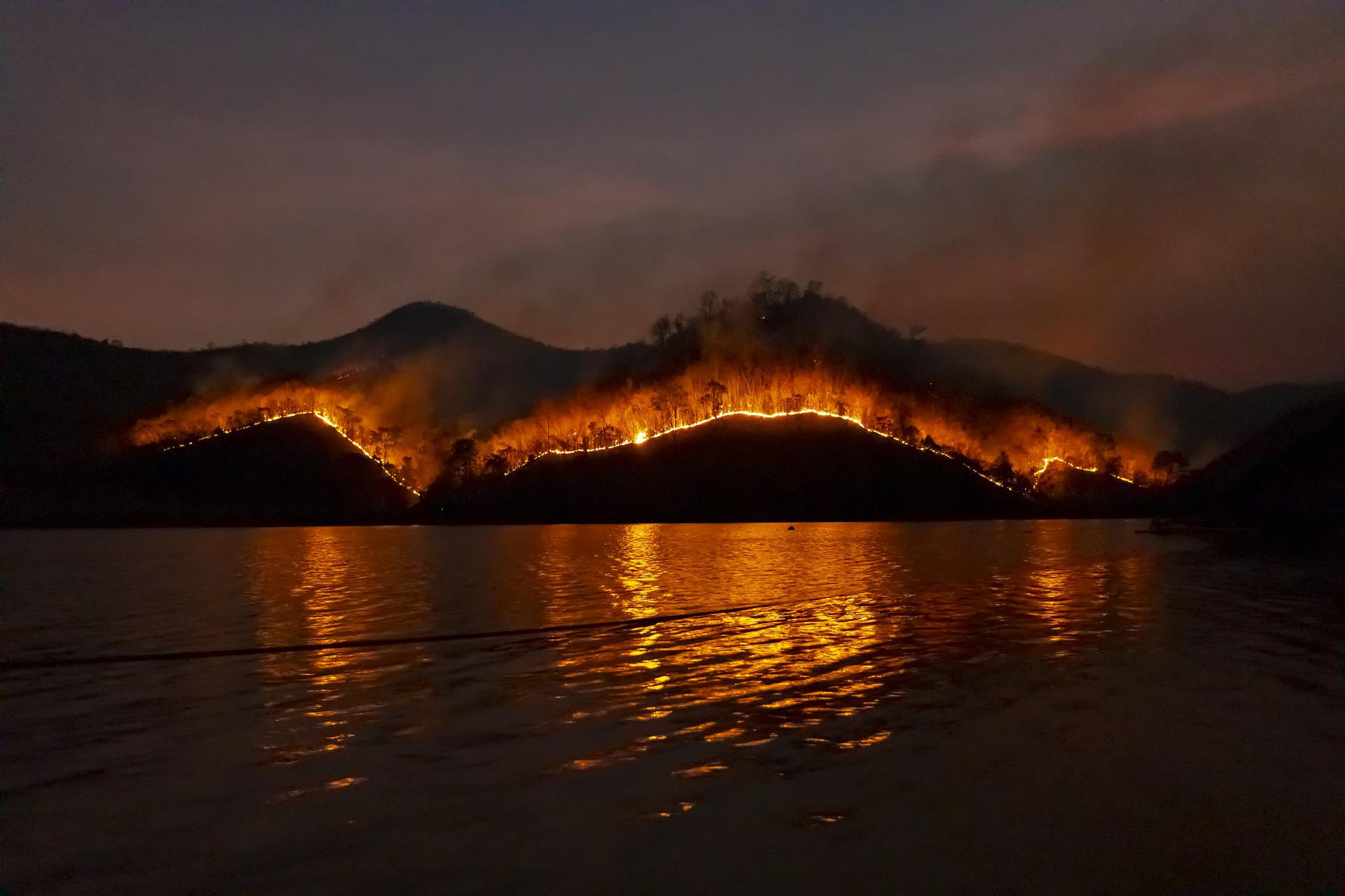
Featured Image Caption: The behavior of wildfires is affected by the shape of the land surface. Fires spread faster up steep slopes. Image Source: Pixabay Free to use under the Pixabay license. No attribution required.
In many regions around the world, wildfires are becoming a larger and larger issue for forests and society. Specifically, Central Europe is expected to become drier and warmer as a result of global climate change, increasing the risk of wildfires in coming years. How can scientists conserve forests and protect society on such a large scale?
How Do Fires Behave?
The way that a wildfire burns and moves once ignited depends on three things: topography (the shape of the land surface), weather (especially temperature and wind speed), and fuel (burnable material, like trees, grass, and fallen leaves). Weather and topographic data are readily available, but there is no existing source for fuel data on the scale of entire forests.
To predict the behavior of wildfires, scientists need 3D information about how the forest (particularly the fuel) is structured. For instance, if a flame were on the ground, are there likely to be tree branches close enough to the ground that they would light on fire, too? If so, would those branches be likely to light other branches of neighboring trees on fire? Fuel structure data is important for predicting fire behavior because fuel density affects how fire spreads, with denser fuel allowing for rapid spread of the fire, as long as the density is not so high that it slows air circulation. To get this kind of data for entire forests, some scientists have turned to remote sensing as a tool, collecting data about a large area from a distance using tools like aerial photography.
Mapping and Modeling
Recently, researchers showed that remote sensing could be used to predict how wildfires would behave in a forest, allowing for better protection of forests and the people who spend time in and around them. They did this using field data and two types of remote sensing, satellite imagery and LiDAR. These data allowed the scientists to estimate where the burnable materials were and model how a fire would move through the forest in a variety of weather conditions.
They conducted their study in the Haard forest in Germany. The forest is about 60 square kilometers(about 23 square miles) and is mostly made up of pine, beech, and oak trees. On the ground, scientists measured many individual trees of each species to estimate the fuel density in the upper branches of trees. They also collected field data on surface fuels at many plots throughout the forest by studying the fallen leaves, twigs, and small plants on the forest floor. These field-based data were used to make approximations about how much fuel was present in a typical tree of each species and on the ground. However, to estimate where these fuels were throughout the forest, the next step was remote sensing.

DerMische, CC BY-SA 4.0 https://creativecommons.org/licenses/by-sa/4.0, via Wikimedia Commons
What’s Remote Sensing?
The researchers at the Haard forest used satellite imagery to map the burnable areas and the locations of the most common tree species in the forest. Hard surfaces like asphalt and different types of trees all reflect light up to satellites differently, allowing scientists to use images taken from above to map burnable or non-burnable materials present in and around the forest.
They also used LiDAR (light detection and ranging) to estimate the forest structure, or the 3D layout of fuels like trees, brush, grass, and more in the forest, particularly the vertical distances between them. To do this, a laser and scanner are commonly attached to an aircraft and flown over an area. As it flies, the laser sends light down to the land surface, and the scanner detects that light after it has reflected up from the surface. It also records the amount of time since the laser emitted the light (the amount of time it took for the light to travel to and from the surface that reflected it). This amount of time depends on the distance from the aircraft to the target surface. Then, by using a GPS and tracking the three-dimensional movements of the aircraft, scientists can recreate the land surface in incredible detail, creating a 3D map of all the objects that reflected the light. This technique helped the researchers determine the height of tree canopies, among other forest structure fuel variables.

Put It All Together and What Do You Get?
By combining field data on fuels, maps of tree species, 3D forest structure fuel data, and topographic maps of the land surface, the researchers were able to model how a wildfire in the Haard forest would behave in a variety of weather conditions. The FlamMap model, a model used by many fire managers to predict fire behavior, estimated how fast different fuel materials would take to ignite depending on this combined forest data, as well as how wet the burnable materials are, how warm it is, and how strong the wind is. The model simulated how wildfires would move and grow if they were first ignited at each of 10,000 random points throughout the forest. These simulations showed which parts of the forest were most likely to burn, and additional simulations even predicted flame lengths. Finally, the model calculated the predicted fire hazard, which depended on the predicted flame length and rate of spread.
In the Haard forest, the FlamMap model predicted that areas with many pine trees, especially on steep slopes, were the most likely to be hazardous in a wildfire. Even on level ground, pine trees drop lots of very flammable needles to the forest floor, creating a very fire-prone environment. They also tend to live in large patches of mostly other pine trees, which allows fire to spread quickly, without obstructions, for large distances. The model also showed that high wind speeds and dry fuel dramatically increased the fire hazards. These results suggested that steep slopes with pine trees might be safer if replanted with fewer, less fire-prone trees, like beeches or oaks.

Sarah Frey, Oregon State University, CC BY-SA 2.0 https://creativecommons.org/licenses/by-sa/2.0, via Wikimedia Commons
A Model Modelling Project
To show the world that remote sensing has a practical role in predicting fire hazards, the researchers at the Haard forest intentionally used widely available technology and cost-effective materials to conduct this study. For example, all the field work was done using basic tools. Additionally, LiDAR data is becoming more and more widely available, especially with the 2018 GEDI satellite’s larger-scale LiDAR data. The practical method employed by these researchers serves as a great example of how fire management around the world could benefit from remote sensing techniques, better protecting forests and society from the increasingly common wildfire hazards of the 21st century.
Reviewed by:
